DJI Flight Path (.SRT) to Google Earth (.KML)

DJI Flight Path Visualization
  1. Select up to 10 DJI drone .SRT files.
  2. Preview individual flight path statistics and 3D flight path thumbnails.
  3. Customize flight path names by clicking on the file name.
  4. Generate and download a single Google Earth .KML file.
  5. Upload the .KML file to Google Earth web to view your flight paths in a roller-coaster style.

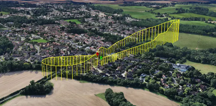
Note: All file processing is performed in your browser. No files (or data of any type) are uploaded/recorded.

Select .SRT files

Processing flight data...

Generate .KML file